SOUTHERN MONGOLIA

Gobi territory is part of uniquely preserved, larger Central Asian ecosystem with the most extreme challenging temperatures for July vary from +20C to +40C while the winter temperature can reach as low as -40C. The unusual feature in a landscape, much of the Gobi is not sandy desert but, soil is mostly hard and bare rock. Gobi received its protected area status in 1975 as the largest National Park in Mongolia. it covers approximately 1.3 Mio square kilometers. Annual rainfall varies from approximately 50mm in the lowlands to about 150mm in higher region; rainfall is most common between June to September. Though rare, rainfall can be sudden and extremely heavy. Spring is characterized by frequent dust storms. The area is prone to storms year-round due to its geographical position in a wind corridor between ranges of Altai mountains. 


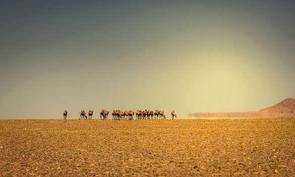
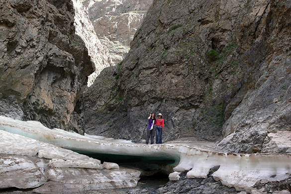
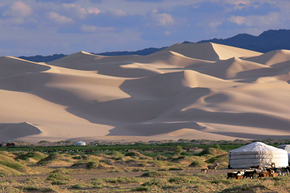
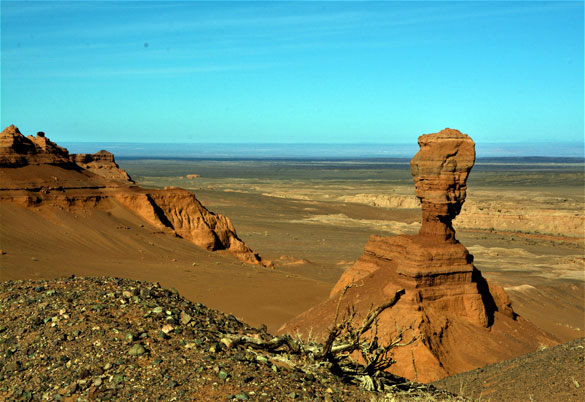
Gobi Gurvan Saihan National Park protects a rich natural, cultural and scientific heritage. Its landscapes, belonging to the desert steppe and desert zone, are of great diversity and host a variety of ecosystems including oasis, salt marshes, mountain steppe and alpine meadow. In the park’s east region, the rugged mountain ranges of “Three beauties” (2825m) rise steeply from the steppe pastures. In the Eastern Beauty Mountains, Yollin Am and Muhar Shivert are unusual features for nature lovers; in the deep and narrow gorge the creek usually remains frozen year-round as its ice builds up to several meter thickness throughout the winter. 


One of the most photographed places - Khongor Els is remote and unremarkable and far form Dalanzadgad its 240km/ 145miles to the west. These dunes are one of the largest moving bodies of sand in the world which lie 180kn/110miles long and travel in a line from the northwest to the southeast. Its called “Singing Sands” due to the sound of downhill moving sand when climbing to the dune’s top.
Not only beautiful singing sands, “Hongoriin Gol” river-a permanent spring creatures a green wetland, which makes for an interesting contrast agains the background and mountain range beyond. 


Sand rock formation of Khermen Tsav opens wider and reds. Its flatness is relieved here and there by dry streambeds. Sand canyons which formed during a thousand of years of erosion are stretched for 15-20km and 100-200m deep. Sand and more gravel are everywhere, and a scattering of dry bush. Sand rock canyons are home to the world re-known discoveries of dinosaurs’ skeleton as well as the first fossilized dinosaur eggs have been preserved at the foot of these sand cliffs. In this area, small herd of Mongolian black tailed gazelle are a common sight darting across the steppe, “flash markings”- their white behind and black tail, serving as a 


Flaming cliffs which were named by paleontologist Roy Chapman Andrews due to red sandstone cliffs glow at sunset are famous to the world with the first nests of dinosaur eggs, new species of dinosaurs, and the fossils of early mammals that co- existed with dinosaurs. In 1922, paleontologist Roy and his team have yielded many important findings of dinosaur fossils that are globally significant to science as they gave important insights into the evolution of vertebrates. The central Asiatic expeditions were a massive undertaking over 120 camels and 40 scientists and technicians.